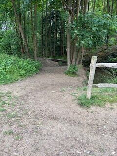
Not wheelchair accessible
Un-mapped and non-formalised path adjacent to path 19, created by walkers walking alongside the stream. There are dips caused by small tributaries to the stream with gradients up to 25%, and forming steps in places. Fallen trees block the path and reduce the overhead clearance. Pairs of trees reduce the path width to under 1 metre. Surface is muddy with exposed tree roots. Path is close to the water edge in places.
This Desire line is approximately 110 metres long with a Mud and tree roots surface
The narrowest point: 50 cm wideSteepest gradient: 25% (1:4)
Waymarked or signposted: NoHas contrasting colours: No
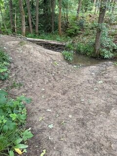
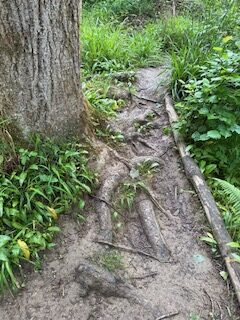
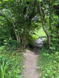
Location: West Sussex
Grid reference: TQ 36899 34367
W3W: ///mashing.fewest.spouting
Added by: Matt OverdVerified by: Matt OverdLast reviewed: May 2025ID: GRAV044
Grid reference: TQ 36899 34367
W3W: ///mashing.fewest.spouting
Added by: Matt OverdVerified by: Matt OverdLast reviewed: May 2025ID: GRAV044