Not wheelchair accessible
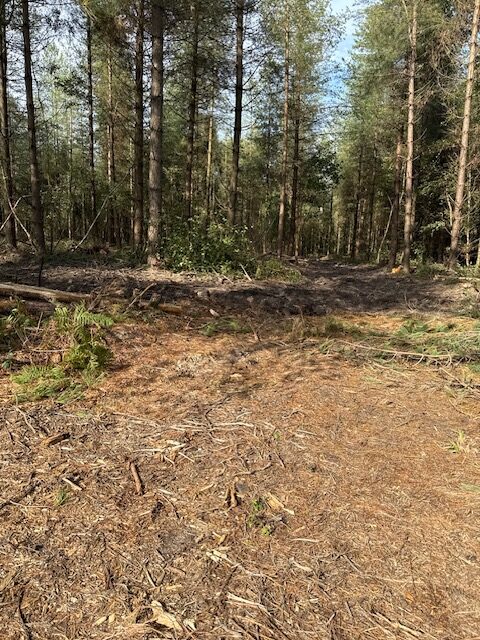
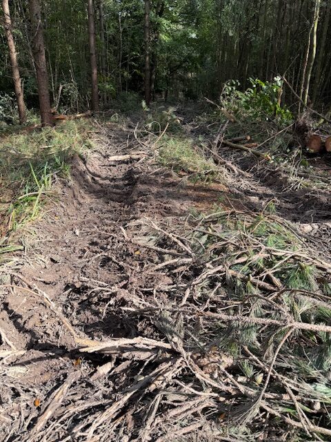
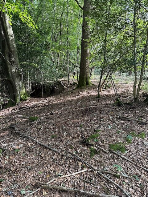
From path 97 this path is heavily rutted due to forest machinery. Gradients up to 10%, it is not possible to measure cross fall. Path is about 2 metres wide, but reduced to 50cm of usable path in places. Turning onto the branch towards the east there is a track covered with discarded branches, which is difficult to walk on. There is a narrow path around the pond on the edge of the bank which is difficult to identify in places due to the discarded forestry waste.
This Forestry track is approximately 300 metres long with a Grass, Soft mud surface
The narrowest point: 0.5 cm wideSteepest gradient: 10% (1:10)
Waymarked or signposted: NoHas raised edges: NoHas contrasting colours: No

Location: West Sussex
Grid reference: TQ 37251 33908
W3W: ///storms.neck.wakes
Added by: Matt OverdVerified by: Matt OverdLast reviewed: September 2025ID: GRAV142
Grid reference: TQ 37251 33908
W3W: ///storms.neck.wakes
Added by: Matt OverdVerified by: Matt OverdLast reviewed: September 2025ID: GRAV142