A lovely walk around this lively and picturesque harbour, with plenty of places to eat and drink and lots of interesting and historic buildings.


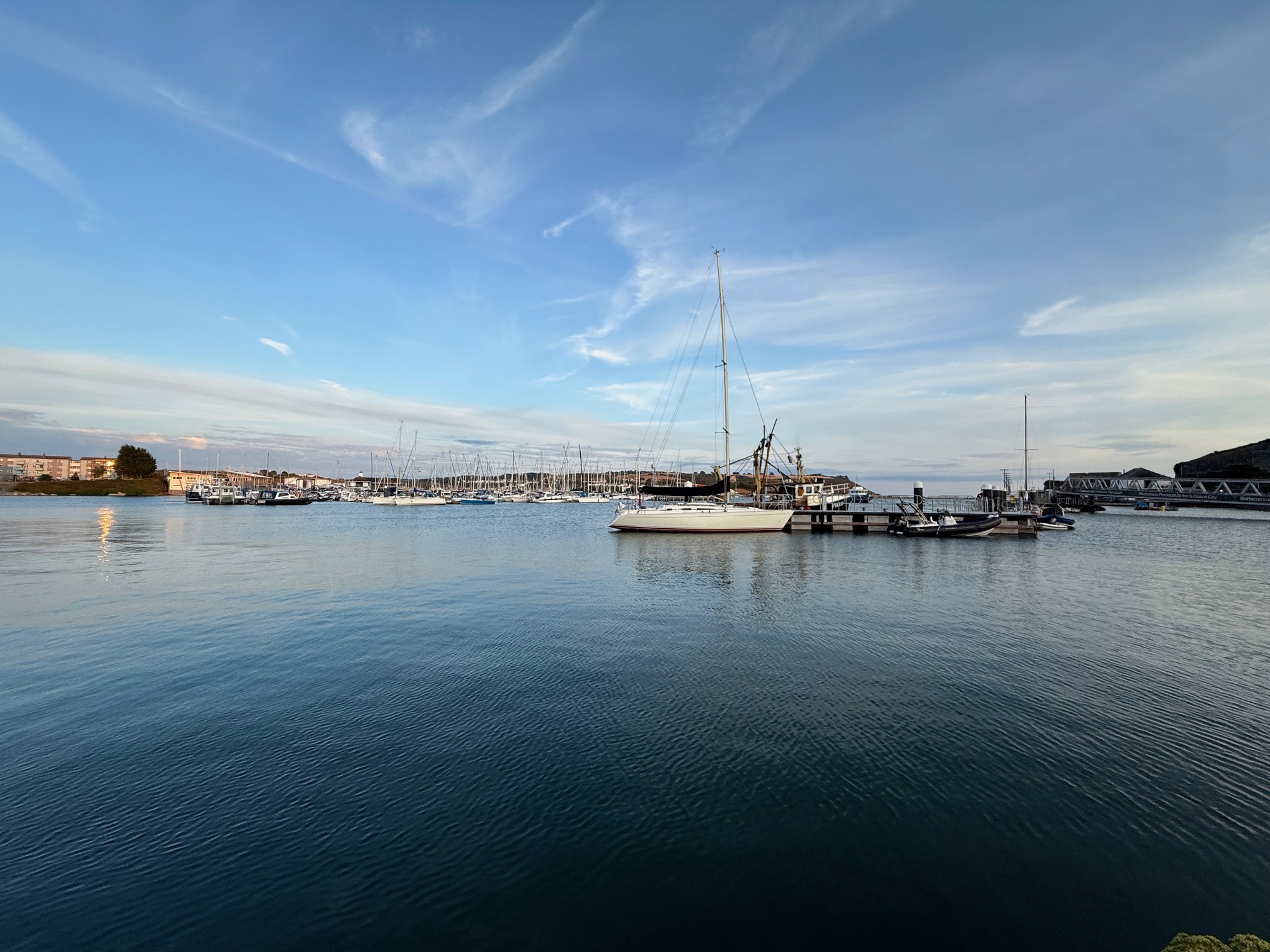
Walk Summary
 Location: Plymouth, Devon, South West England
 Distance: 1.1 miles (1.8 km)
 The walk is circular
 Ascent: 17 metres (55.8 feet)
 Type of walk: City, Harbour, Waterfront
 Points of interest: Aquarium, Harbour, Interesting building, Monument, Museum, Seafront, Shopping
 Trails and Ways: King Charles III England Coast Path, South West Coast Path
Location: Plymouth, Devon, South West England
Distance: 1.1 miles (1.8 km) The walk is circular Ascent: 17 metres (55.8 feet) Type of walk: City, Harbour, Waterfront
Points of interest: Aquarium, Harbour, Interesting building, Monument, Museum, Seafront, Shopping
Trails and Ways: King Charles III England Coast Path, South West Coast Path
Getting here
Starting point: Harbour car park (multi story)
Postcode: PL4 0DX
Grid reference: SX 486 541
W3W: ///lows.smart.liner
End point: The walk is circular
 Parking: Dedicated accessible parking, In a pub car park, Paid for parking
Car park has height barrier with a restriction of 2m
Car park opening times are Mon-Sat 06:30 - 23:30, Sun 08:30 - 23:30 (24hr parking) Accessible parking also available on The Quay (PL1 2BW). More paid for parking available at Exchange Street (PL4 0HB) and Vauxhall Street (PL4 0DD) Public Transport: Bus, Tram
Plymouth Railway Station is 0.8 miles (1.3km) away. Buses from the railway station to Exeter Road 300m or the circular city route to Mayflower Steps. Cost of entry: Free
Starting point: Harbour car park (multi story)Postcode: PL4 0DX
Grid reference: SX 486 541
W3W: ///lows.smart.liner
End point: The walk is circular
Parking: Dedicated accessible parking, In a pub car park, Paid for parkingCar park has height barrier with a restriction of 2m
Car park opening times are Mon-Sat 06:30 - 23:30, Sun 08:30 - 23:30 (24hr parking) Accessible parking also available on The Quay (PL1 2BW). More paid for parking available at Exchange Street (PL4 0HB) and Vauxhall Street (PL4 0DD)
Public Transport: Bus, TramPlymouth Railway Station is 0.8 miles (1.3km) away. Buses from the railway station to Exeter Road 300m or the circular city route to Mayflower Steps.
Cost of entry: Free
Facilities
 Seats available
  Toilets available Accessible, Baby changing, Gender neutral
50p charge applies. RADAR key required for accessible toilet Food and drink available Cafe/s, Pub/s nearby, Shop/s, Takeaway/s Not a waymarked route
 No staff available to assist
Seats available Toilets available Accessible, Baby changing, Gender neutral50p charge applies. RADAR key required for accessible toilet
Food and drink available Cafe/s, Pub/s nearby, Shop/s, Takeaway/s Not a waymarked route No staff available to assist
Accessibility summary
 Challenging for wheelchairs

Paved paths and areas of uneven cobbled streets. Some small kerbs. Challenging for pushchairs
 No stiles
 No steps
 Touch free
 No gates
 No narrow gaps
 All paths are at least one metre wide
 Walking surface: cobbles, paved or tarmac
 Well used paths, people likely to be nearby
 No road crossings
 Not car free, includes: crossing a car park, road crossings, walking alongside roads on pavements, walking on roads without pavements
Challenging for wheelchairs
Paved paths and areas of uneven cobbled streets. Some small kerbs.
Challenging for pushchairs
No stiles
No steps
Touch free
No gates
No narrow gaps
All paths are at least one metre wide
Walking surface: cobbles, paved or tarmac
Well used paths, people likely to be nearby
No road crossings
Not car free, includes: crossing a car park, road crossings, walking alongside roads on pavements, walking on roads without pavements
Notes
Caution:
Some un-fenced drops to the water. Parts of the walk are busy nightlife spots.
Route Directions:
1. From the Harbour Car Park head to the road (Lockyers Quay) and turn left. At the mini roundabout bear left and head to the left of the aquarium.
2. Pass the entrance to the aquarium. Then head down the ramp or steps ahead and cross over the swing bridge (you will need to wait if the bridge is open).
3. At the road (The Barbican) turn right and follow the path alongside the quay.
4. Follow the quay around to the left. This area can be quite busy in the evenings as there are many bars and restaurants.
5. Follow the quay around to the right. Then bear right, pass The Three Crowns and turn left onto Exchange Street.
6. Turn right onto Vauxhall Street. When the road bends to the left bear right and onto the quay ahead. Then follow alongside the old railway tracks.
7. Follow the quay around to the left and alongside the car park.
8. Turn right and continue alongside the quay.
9. Turn right and continue alongside the quay.
10. Head around the small inlet and continue alongside the water. Then cross the car park ahead (in front of the steakhouse) and continue to the water.
11. At the railings by the water turn left and follow the path along the quay.
12. Follow the path around to the right and pass the cookhouse. The bear left onto Lockyers Quay and to the Harbour car park.
Route number: DEV001Added by: One Mile WalksVerified by: One Mile Walks
Last reviewed: August 2026
Photo credit: Matt Overd
Something not right? Got a comment?