No longer visible
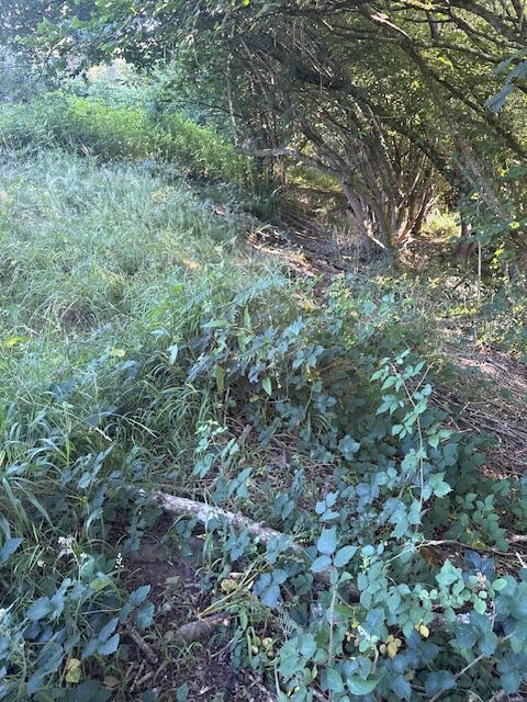
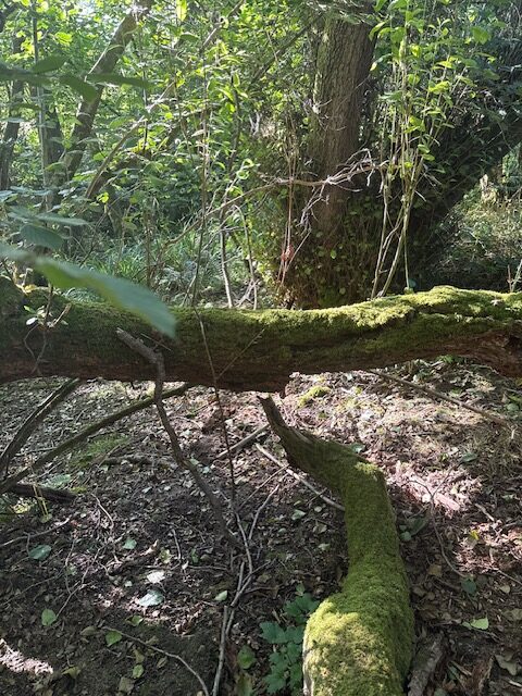
The path begins from Path 66 and is an uneven soft mud surface, with a cross fall slope of up to 30%. The path is overgrown and covered in fallen trees and logs. It is difficult to identify and follow the line of the path without gps. Overhead height reduced to about a meter due to overgrowth.
Path type: Footpath
Length (approximately): 90 metres long
Location: West Sussex
Grid reference: TQ 36306 33848
W3W: ///residual.devoured.string
Added by: Matt OverdVerified by: Matt OverdLast reviewed: July 2025ID: GRAV104
Grid reference: TQ 36306 33848
W3W: ///residual.devoured.string
Added by: Matt OverdVerified by: Matt OverdLast reviewed: July 2025ID: GRAV104